In the townland of Mullaghderg near KIncasslagh in west Donegal lies a headland named Rinnalea on the ordnance map or locally called The Ranny Liaths, a Hiberno-English version from the vernacular Na Rannaigh Liath meaning the grey headland at sea level.
Although recorded in state papers from the Ulster PIantation as Rinnalea, I find that the name has evolved because the heath covered headland is neither grey nor at sea level.
Situated in the back garden of the Mullaghderg ale-house formerly known as the Red House, the Teach Bán and later the Tower Bar there was a medieval church and graveyard called Cill Feic which according to tradition meant the churchyard of the foreigner. Looking in Irish English dictionaries the word Feic is not to be found and the only word for foreigner is Gall as in Dún na nGall (Donegal) or na gallólaigh(gallowglasses) meaning foreign warrior.
This holy site is now lost in the mist of time with advancing overgrowth covering the simple grave markers. William Dudgeon of Mullaghderg who died in Dunfanaghy Workhouse in 1885 was the last to be laid to rest here, thus ending a millennium of use. According to Canon Maguire in his book History of the Diocese of Raphoe, this cell was founded by Naomh Dubhtach of Innisdooey who flourished in the tenth century.
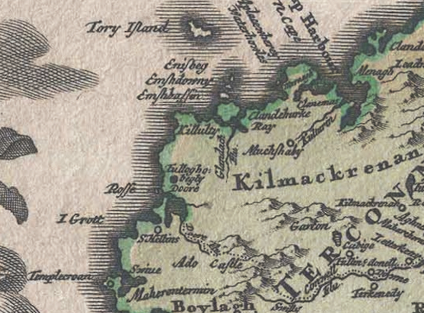
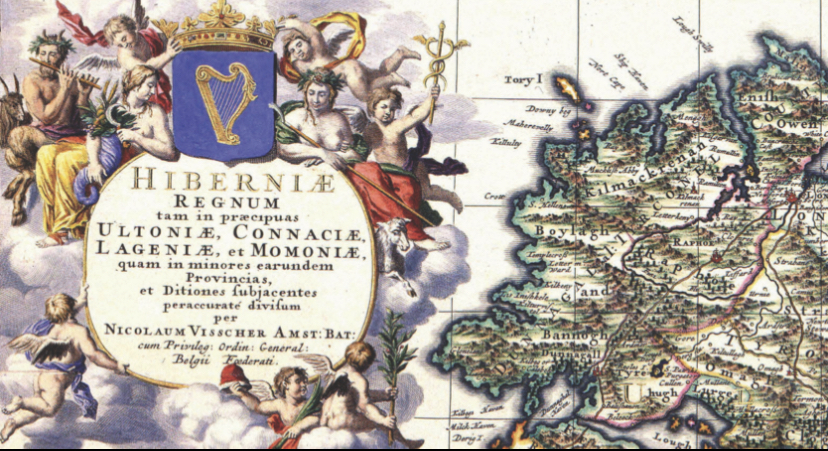
From the sixteenth century and for the next three hundred years English and European cartographers have been inserting a place called St Helens or S~Helena in an area between Annagry and Keadue strands and sometime they place it on the headland or bay named S Helens Head or Haven. St Helena gradually disappears from the charts towards the end of the 18th century with Mullaghderg appearing for the first time in 1759. Mullaghderg and S Hellens (or various forms of both names) never appeared together on the same map.

But what could St Helena mean?
There are a number of places with this name in England and elsewhere, but only a few have been recorded in Ireland. One of these is situated near the present day Euro-Port of Rosslare in Co. Wexford. Now known as Killilane, it is a phonetic translation of Cill Fia or Liath, a medieval church. Killea on the Donegal-Derry border although not phonetically changed, has many possible meanings such as Cill Liath (grey church), Cill Aodha (Hugh’s church), Cill Fhiach (St Fiach’s church). Cill Fiach could also mean the church of the ravens.
Whatever the adjective connected to the word Cill or Hell, the church recorded in west Rosses by cartographer William Petty in his map of Ireland 1689 with an icon representing a ecclesiastical centre lends it name to the headland Rinnalea.
Rev. Frederick Corfield used the title Perpetual Curate of Mullaghderg as late as 1850. Since the reformation and establishment of the Protestant faith in Ireland, Anglicans often took over church buildings that had their origins in ‘Celtic’ christianity.
Was Rinnalea originally called Rann Cill Liath meaning the headland of the grey church or abbey or the headland of the church with an long forgotten description? Did cartographers take the old place name and record it phonetically as Hel-ene Head and St Helena?
Researched and written by Jimmy Duffy 2022


February 1, 2022 at 6:46 am
Thank you for a very interesting piece of local history.
LikeLike
February 5, 2022 at 8:23 am
Fascinating – thank you
LikeLike